The classifier of types of permitted use of land plots was adopted in 2014.
The new classifier contains 155 types of permitted use.
In this article I will show:
- how to use an online classifier of types of permitted use of land plots for free;
- what to do with old types of permitted use that were not included in the classifier;
- how to establish compliance of the type of permitted use with the new classifier.
So let's get started.
Free online Classifier of types of permitted use of land plots.
At the bottom of the article you will find an online service with a classifier of permitted use.
The information in the classifier is divided into 3 columns:
- name of the type of permitted use,
- description of permitted use,
- code.
Each column (vertical column) has a built-in sorter.
The first and second columns sort the types of permitted uses in alphabetical order.
The third column sorts by numerical code of the type of permitted use.
Sorting works in forward and reverse order.
Why is a classifier needed?
In order to structure and classify information about VRI, in 2014 Order 540 “On approval of the classifier of types of permitted use of land plots” was adopted.
In 2015, changes were made that are in effect today.
Prior to this, there were no clear rules for the formulation of types of permitted uses, and they had no classification.
Some names were quite vague and did not have a clear meaning.
The owner of the site chooses the activity in accordance with the main or auxiliary VRI himself, without additional permits . For a conditional VRI, the owner must obtain permission.
To summarize: a classifier of permitted use of land plots is a document containing a list of all types of permitted use. Many of them acquired a more specific formulation of meaning, which does not imply other options for its interpretation.
The classifier of types of permitted use has 155 positions.
In other words, the legislation establishes one hundred and fifty-five types of permitted use of sites.
For ease of use, the online classifier of types of permitted use has a built-in search.
When entering characters, the service automatically displays the types of permitted use corresponding to the request.
The search works across all rows and columns of the classifier.
If you know the exact code, then enter the numbers in the search field.
The service will display the type of permitted use corresponding to the entered code.
If you type the text, the permitted use classifier will display all matching results.
After viewing the result, find the desired VRI.
What to do with old types of permitted land use?
The legislation answers this question very clearly.
Old types of permitted use established before the adoption of the classifier are recognized as valid.
In this case, it does not matter whether the old VRIs correspond to the classifier or not.
In other words, the type of permitted use established before December 24, 2014 is considered valid.
The correspondence or non-compliance of the old VRI with the new species from the classifier has no legal significance.
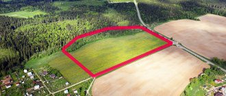
Type of permitted use of land: classifier
This essential characteristic of the allotment complements the properties of the intended purpose and is divided into the following types of land plots by type of use:
- main type of use of the land plot;
- conditionally permitted;
- additional.
These groups of types of permitted use of land plots provide legal boundaries within which the land plot allows the owner to dispose of it in accordance with its intended purpose.
Let's take a closer look at what types of permitted uses of land are in the following video:
Below we present the current VRI at the moment. Under the first table you will find a button, when you click on it, a more detailed classifier with types of land will appear.
General structure of the classifier (GSR)
Detailed VRI classifier. Types of land plots
A detailed VRI classifier will open by clicking on the button below. THE TABLE IS VERY BIG!
Main types of permitted use of land plots in settlements
These parameters are defined as extremely fixed, rigid frameworks that limit the owner or other title holder. The main mode of use of a land plot is assigned in all cases involving ownership of the plot and the extraction of useful properties from it.
If the owner is presented with only the main type of use, then he is obliged to follow the regulations provided for the intended purpose of the plot that he owns . For example:
- category of land plots – settlement lands;
- intended purpose – low-rise residential building;
- permitted use of land plots – main classifier.
In this case, it is allowed to build a house of 1-2 floors, without outbuildings and a garage. In order to develop a homestead on a plot of land, it is necessary to obtain conditionally permitted use of the land plot.
Conditionally permitted
A conditionally permitted type of use of a land plot is an expansion of the regulations established by the main type of intended use, subject to the permission of actions granted by the local government authority.
Arises from:
- Administration permission granted at the time of allotment of the site to the tenant or owner.
- Permission from the administrative commission , adopted at a public hearing, at the request of the owner.
To obtain conditionally permitted types of land use, the status of landowner is required . The conditions that such a purchase requires must comply with:
- the intended purpose of the memory, without violating them;
- zoning of the territory;
- urban planning plan;
- architectural context.
Therefore, the application for a change in type is accompanied by documentation from the department of urban planning and architecture, confirming the admissibility of certain works declared by the owner.
Application to change the type of permitted use of a land plot.
Additional
These include the nuances of the activities of the rights holder of the land plot, which do not make significant changes to the surrounding context of the development and do not require registration with Rosreestr.
Auxiliary types of permitted use of land allow adjustments to be made at the discretion of the owner of the land plot ; for this there is no need to apply for a special permit.
Auxiliary use of land plots should be based on the existing main or conditionally permitted type, and based on its specifics.
For example, if outbuildings are permissible, the copyright holder has the right to build a garage or other structure. And if he is in charge of only the main permit - to arrange a place to park a car.
How to establish compliance of the type of permitted use with the new classifier?
The owner of the land plot has the right to establish compliance of the permitted use with the classifier.
As a rule, the need to establish compliance arises for areas with old VRI.
To establish compliance, you must submit an application either:
- to a government agency,
- or to a local government authority.
The authority is selected depending on the authority to establish and change the types of permitted uses.
For reference.
For 2 ways to change the type of permitted use of a site, see the article at the link.
There you will also find a tool for filling out the Declaration to change the type of permitted use of the land.
Most often, the authorized body is the local government.
If you are in doubt about which body to submit an application for establishing compliance, then submit it to the local administration.
In May 2021, the number of objects in the Register of Prospective Projects (RPP) increased by 35. During the month, 343 projects were added to the PRP, and 308 left the Register.
The new module of the ERZ.RF portal “Register of Promising Projects” was put into commercial operation in January 2021.
Over five months, 149 market participants became RPP users. In May 2021, the number of objects in the Register of Prospective Projects (RPP) increased by 35. During the month, 343 projects were added to the RPP, 308 dropped from the Register. The most objects were added in Moscow (31), St. Petersburg and the Sverdlovsk region (18 each) , as well as in the Moscow region and Novosibirsk region (16 each).
The dynamics of RPP growth by region are presented in the table.
| Region | Objects in the RPP, total as of 06/01/2021 | For May 2021 | |
| New | Attrition | ||
| Russian Federation | 4489 | +343 | -308 |
| Moscow | 395 | +31 | -30 |
| Moscow region | 182 | +16 | -8 |
| Saint Petersburg | 162 | +18 | -25 |
| Leningrad region | 67 | +6 | -17 |
| Krasnodar region | 160 | +6 | -6 |
| Altai region | 44 | +3 | -5 |
| Amur region | 35 | +3 | 0 |
| Arhangelsk region | 41 | +2 | -5 |
| Astrakhan region | 11 | 0 | 0 |
| Belgorod region | 46 | +4 | -1 |
| Bryansk region | 16 | +4 | -3 |
| Vladimir region | 90 | +1 | -6 |
| Volgograd region | 59 | +4 | -8 |
| Vologda Region | 26 | +4 | -2 |
| Voronezh region | 63 | +8 | -7 |
| Sevastopol | 6 | 0 | 0 |
| Jewish Autonomous Region | 0 | 0 | 0 |
| Transbaikal region | 9 | +1 | -1 |
| Ivanovo region | 31 | +6 | 0 |
| Irkutsk region | 30 | +4 | -3 |
| Kabardino-Balkarian Republic | 97 | +1 | 0 |
| Kaliningrad region | 129 | +12 | -11 |
| Kaluga region | 37 | +1 | -3 |
| Kamchatka Krai | 5 | 0 | 0 |
| Karachay-Cherkess Republic | 9 | +1 | 0 |
| Kemerovo region | 72 | +4 | -4 |
| Kirov region | 28 | +2 | -3 |
| Kostroma region | 43 | +7 | 0 |
| Krasnoyarsk region | 53 | +3 | -4 |
| Kurgan region | 26 | +1 | -5 |
| Kursk region | 29 | +1 | -1 |
| Lipetsk region | 38 | +4 | -1 |
| Magadan Region | 1 | 0 | 0 |
| Murmansk region | 3 | 0 | 0 |
| Nenets Autonomous Okrug | 12 | 0 | -1 |
| Nizhny Novgorod Region | 59 | +7 | -2 |
| Novgorod region | 11 | +1 | 0 |
| Novosibirsk region | 156 | +16 | -22 |
| Omsk region | 64 | +7 | -1 |
| Orenburg region | 32 | +3 | 0 |
| Oryol Region | 14 | 0 | -2 |
| Penza region | 21 | +1 | -3 |
| Perm region | 75 | +8 | -6 |
| Primorsky Krai | 114 | +12 | -6 |
| Pskov region | 15 | +2 | -5 |
| Republic of Adygea | 12 | +1 | 0 |
| Altai Republic | 3 | 0 | 0 |
| Republic of Bashkortostan | 66 | +4 | -7 |
| The Republic of Buryatia | 4 | 0 | 0 |
| The Republic of Dagestan | 6 | +1 | 0 |
| The Republic of Ingushetia | 1 | +1 | 0 |
| Republic of Kalmykia | 10 | +1 | 0 |
| Republic of Karelia | 12 | +1 | 0 |
| Komi Republic | 13 | 0 | -1 |
| Republic of Crimea | 38 | +2 | -3 |
| Mari El Republic | 27 | +2 | -1 |
| The Republic of Mordovia | 32 | +4 | -2 |
| The Republic of Sakha (Yakutia) | 90 | +3 | -3 |
| Republic of North Ossetia-Alania | 10 | +3 | 0 |
| Republic of Tatarstan | 158 | +9 | -4 |
| Tyva Republic | 21 | 0 | -10 |
| The Republic of Khakassia | 15 | +1 | 0 |
| Rostov region | 105 | +8 | -4 |
| Ryazan Oblast | 30 | +1 | -5 |
| Samara Region | 77 | +4 | -3 |
| Saratov region | 33 | +2 | -1 |
| Sakhalin region | 58 | +1 | 0 |
| Sverdlovsk region | 156 | +18 | -2 |
| Smolensk region | 53 | +3 | -3 |
| Stavropol region | 40 | +4 | -1 |
| Tambov Region | 34 | +4 | -2 |
| Tver region | 29 | +1 | -1 |
| Tomsk region | 31 | +2 | -4 |
| Tula region | 108 | 0 | -5 |
| Tyumen region | 97 | +4 | -18 |
| Udmurt republic | 32 | +5 | -2 |
| Ulyanovsk region | 32 | +3 | -5 |
| Khabarovsk region | 6 | +2 | 0 |
| Khanty-Mansiysk Autonomous Okrug - Ugra | 136 | +6 | -2 |
| Chelyabinsk region | 95 | +14 | -2 |
| Chechen Republic | 12 | 0 | -3 |
| Chuvash Republic-Chuvashia | 20 | +2 | -3 |
| Chukotka Autonomous Okrug | 3 | 0 | 0 |
| Yamalo-Nenets Autonomous Okrug | 87 | +3 | -1 |
| Yaroslavl region | 81 | +8 | -3 |
REFERENCE
Register of promising projects
— an interactive service containing a description of housing construction projects being prepared for construction and sale, data on which is not available in the Unified Housing Information System.
Information sources:
• Unified State Register of Expertise Conclusions on Design Documentation for Capital Construction Projects (GIS USRZ);
•
public regional/municipal registers of issued construction permits;
•
publications about residential projects planned for construction (media, social networks, telegram channels, etc.);
•
messages from housing developers (news, press releases, inside stories, etc.).
Main functionality:
•
interactive presentation (table, list, map) and selection of data about objects using filters;
•
uploading data about objects (Excel file);
•
notification system via E-mail (about new objects, stage changes, etc.).
Other publications on the topic:
137 market participants became RPP users as of May 1, 2021
As of April 1, 2021, 134 market participants became RPP users
As of March 1, 2021, 129 market participants became RPP users
During the first month of operation of the Register of Prospective Projects of the ERZ.RF portal, the number of its users reached 58
With funds from Sberbank, the CDS Group will build a satellite city of St. Petersburg for 300 thousand inhabitants
Sberbank will finance St. Petersburg projects of the Etalon Group for 27 billion rubles.